Begoml (Byahoml’)
 |
The first written records of Begoml date to 1582 and identify it as a village on an estate belonging to the Bishop of Vil'nya at Vaucha in the Minsk povet (administrative region) of the Grand Duchy of Lithuania. By 1861, it had become the central volost (county) of Borisovsky Uyezd. The main town of the volost by 1886, it then comprised a village of 43 households, a church, a school, and a hospital. In 1924 it became the centre of Begoml District and on September 27, 1938 it was designated an urban settlement. Since 1960, Begoml has been part of Dokshitsy.
During the German-Soviet War Begoml and the surrounding district were occupied by the Wehrmacht. On July 2 1941, at about 12:00 midday, a vanguard of 39 tanks of the 3rd Panzer Group drove straight into the township. A Soviet partisan movement then formed and began to counterattack. This included nine partisan brigades working with other separate groups. Guerilla operations to clear German forces from the area continued until the arrival of the Red Army on 1 July 1944.
During the war, Begomlian guerrillas operated from a pre-war airfield. This fell into disuse after the conflict and the land was subsequently used to build apartments. Today, the neighborhood is still called "The Airdrome".
The history of Begoml has inspired poets and writers. On June 29, 2009, by decree of the Belarusian President, Begoml, along with 21 other localities in the Republic of Belarus, was awarded a pennant "For courage and resilience during the years of the Great Patriotic War".
Map - Begoml (Byahoml’)
Map
Country - Belarus
 |
 |
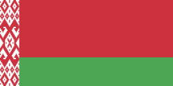
| Flag of Belarus | |
Until the 20th century, different states at various times controlled the lands of modern-day Belarus, including Kievan Rus', the Principality of Polotsk, the Grand Duchy of Lithuania, the Polish–Lithuanian Commonwealth, and the Russian Empire. In the aftermath of the Russian Revolution in 1917, different states arose competing for legitimacy amid the Civil War, ultimately ending in the rise of the Byelorussian SSR, which became a founding constituent republic of the Soviet Union in 1922. After the Polish-Soviet War, Belarus lost almost half of its territory to Poland. Much of the borders of Belarus took their modern shape in 1939, when some lands of the Second Polish Republic were reintegrated into it after the Soviet invasion of Poland, and were finalized after World War II. During World War II, military operations devastated Belarus, which lost about a quarter of its population and half of its economic resources. The republic was redeveloped in the post-war years. In 1945, the Byelorussian SSR became a founding member of the United Nations, along with the Soviet Union.
Currency / Language
| ISO | Currency | Symbol | Significant figures |
|---|---|---|---|
| BYN | Belarusian ruble | Br | 2 |
| ISO | Language |
|---|---|
| BE | Belarusian language |
| RU | Russian language |


